Exclusive Skógar-Fimmvörðuháls Day Hike
Tours
Outdoor activities
Outdoor sports
Nature & adventure
Hiking
Hidden gems
National parks
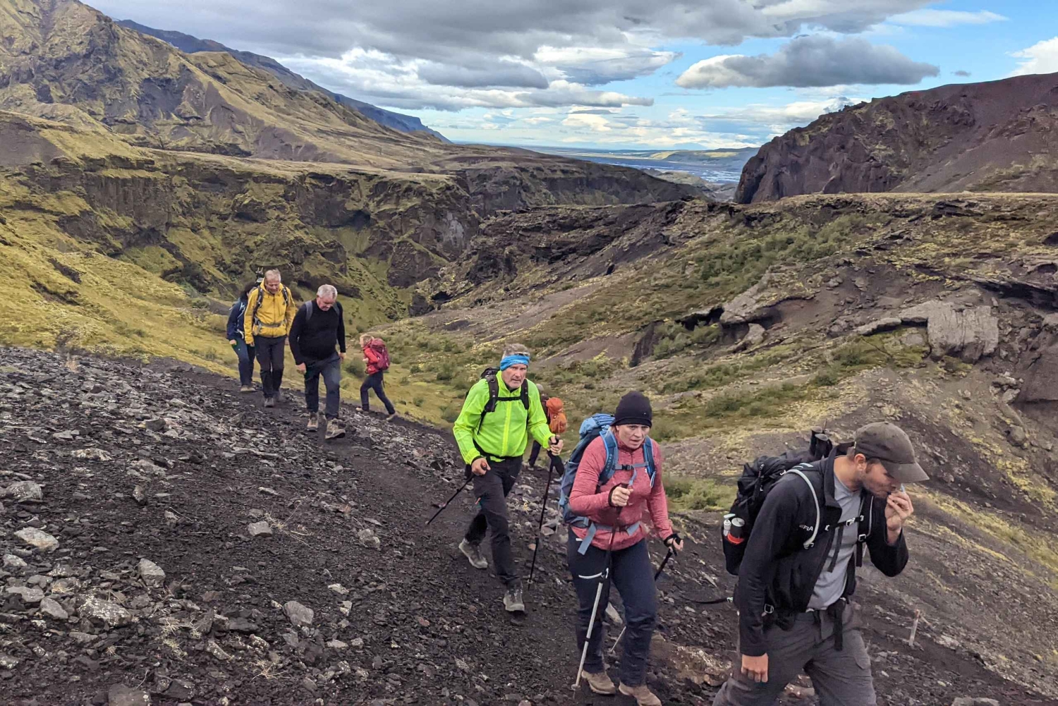
The Fimmvörðuháls hike, from Skógar to Þórsmörk, is one of Iceland’s most famous and breathtaking trekking routes, with dramatic waterfalls, volcanic landscapes, and panoramic mountain views.
Highlights
- Fimmvörduháls trail will take you up through “Waterfall Way”
- If we are lucky we can see volcanoes, glaciers, and the highlands.
- Catch your breath, enjoy the view, and get ready for an amazing day.
Description
Fimmvörðuháls Hiking Adventure – From Skógar to Þórsmörk
Embark on one of Iceland’s most iconic hiking adventures — the legendary Fimmvörðuháls Trail, a journey that takes you between glaciers, past cascading waterfalls, and across newly formed volcanic landscapes.
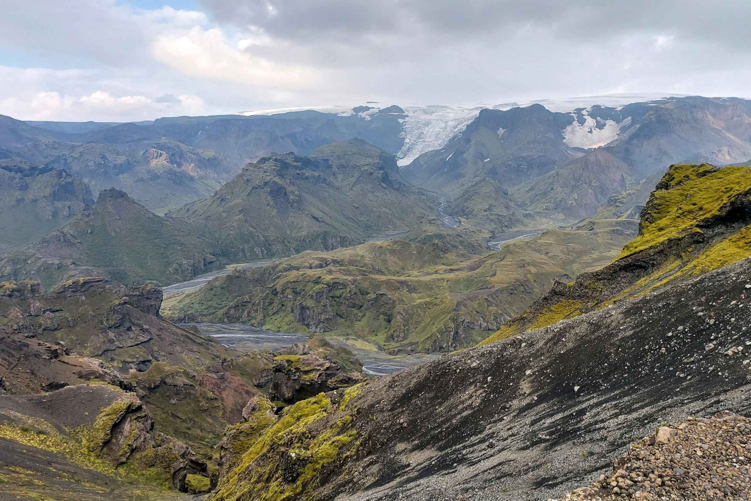
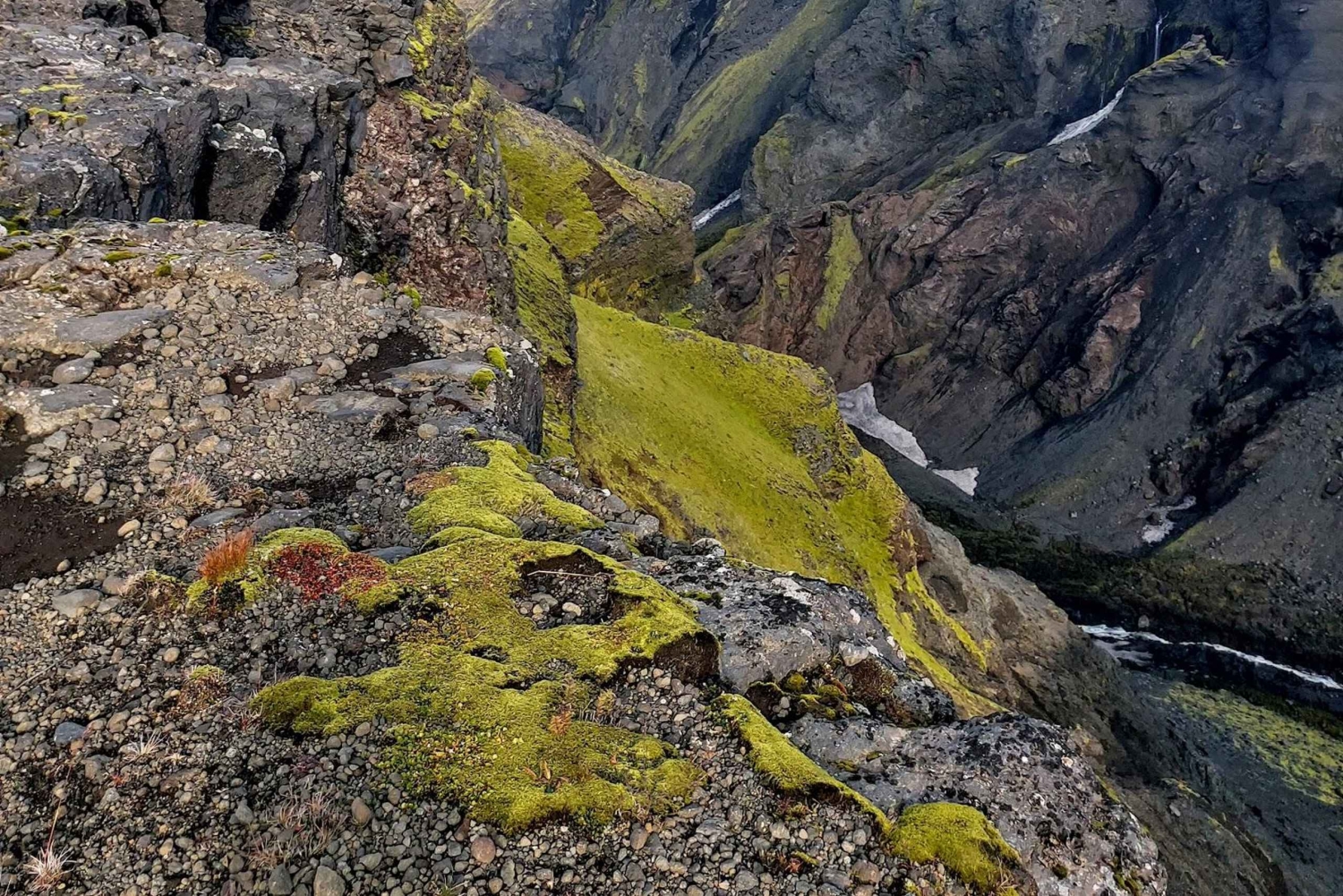
We begin our day at the majestic Skógafoss Waterfall, where the 60-meter curtain of water marks the start of our 25-kilometer trek toward Þórsmörk Valley. The trail winds along the Skógá River, where no fewer than 26 waterfalls tumble through a rugged canyon — an unforgettable stretch known as Waterfall Way.
As we ascend, the landscape transforms dramatically. We climb between the glaciers Eyjafjallajökull and Mýrdalsjökull, crossing the site of the famous 2010 Eyjafjallajökull eruption. Here, you’ll walk on the new lava fields and stand atop the twin craters Móði and Magni, formed in that very eruption.
From this volcanic ridge, we begin our descent into the lush Þórsmörk Valley, a green oasis surrounded by glaciers, mountains, and vast canyons. The views are simply breathtaking — a panorama of Iceland’s wild heart where fire meets ice.
At the end of the trail, our Super Jeep will meet us in Þórsmörk for a scenic return drive. Along the way, we’ll stop at Gígjökull Glacier, where floodwaters from the 2010 eruption reshaped the land, and finish with a visit to the enchanting Seljalandsfoss Waterfall — a perfect ending to a day filled with natural wonders.
Note: Depending on trail and weather conditions, this hike may also be operated in reverse — from Þórsmörk to Skógar.
Tour Facts
Distance: 25 km (15.5 miles)
Elevation Gain: 1,400 m (4,600 ft)
Duration: 8–10 hours (average), up to 12 hours depending on pace
Difficulty: Challenging – suitable for fit hikers with mountain experience
Includes
Private English-speaking guide.
Transport back from Þórsmörk to Skógar.
Important Information
- Warm outdoor clothing, waterproofed jacket and pants, head-wear, gloves, appropriate hiking boots/shoes, some snacks, lunch
Easy cancellation
Cancel up to 24 hours in advance for a full refund